Waasland Cuesta

The geosite is located on the south side of the Waasland Cuesta between Waasmunster and Rupelmonde and borders the Durme and the Scheldt to the south. On the elevation map, the Waasland Cuesta forms the extension of the Boom Cuesta. The breakthrough valley of Hoboken is the boundary between the two cuestas and a passage for the Scheldt. The original relief of the steep cuesta front has been locally disturbed by some stream valleys, clay pits and the fort of Steendorp. The cuesta ridge descends with a gentler slope to the north and is capped by the Wase Scheldt polders.

51.17589823315, 4.3532535386578

Schematic cross-section from north to south through the Waasland cuesta.

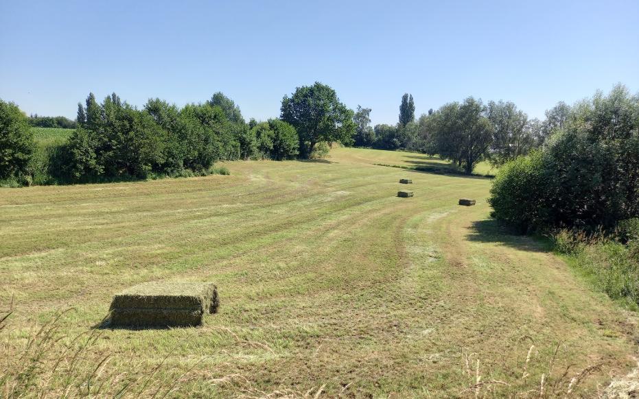
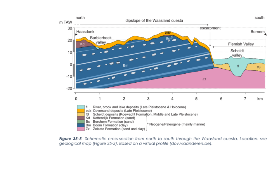
Formation of a cuesta

A cuesta is an asymmetrical ridge and occurs when geologic layers become sloping and then do not erode at the same rate due to their different composition. The sloping layer that erodes at a slower rate remains partly as an elevation in the landscape. Where the softer layer is eroded, a steep slope emerges perpendicular to the hard layer: the cuesta front. Parallel to the sloping erosional layer, a softer slope forms: the cuesta ridge. The formation of the Waasland Cuesta started ca. 32 million years ago. Between c. 32 million and 30 million years ago, the sea in northern Belgium and the Netherlands was 50 to 150 m deep and deposited (Boom) clay (Boom Formation). Due to a combination of plate tectonics and climate fluctuations, the sea depth changed regularly during this period. As a result, the Boom Formation is not a homogeneous clay layer. It consists of alternating layers of silt, chalk and organic material. These layers form a characteristic pattern of horizontal light and dark gray bands.

Wase Cuestra - tussen Elversele en Temse (gemaakt door Jonathan Jacops)

Slope adjustement of the Eocene layers

While sedimentation occurred in the North Sea basin, plate tectonics in southern Europe caused the formation of mountain ranges. As the land lifted in the south, the Earth's crust lowered in the north and sediments moved into a north-northeast sloping position. Due to the slope elevation to above sea level, the marine sediment layers from the Neogene became exposed to erosion. However, the clayey layers of the Formation of Boom were more resistant to this than the sandy layers. This allowed the Flemish Valley to cut deeply into the sand but not into the Boom clay. Throughout the Pleistocene, the Flemish Valley gradually became filled in until the end of the last ice age and during the Holocene, the present-day Scheldt Valley formed just south of the Waasland Cuesta. During the last ice age, a thin layer of (cover) sand and, especially in the southeast, sandy loam was also deposited.

Cultural landscape on the cuesta

The landscapes on the Waasland Cuesta were not suitable for intensive agriculture due to unfavorable soil until the Middle Ages. Etymologically, the word "Waas" goes back to terms indicating mud or infertile soil. Until the 13th century, more than half of the Waasland remained a large "primeval forest," known as the Koningsforeest. This royal hunting ground was owned by the Counts of Flanders during the Middle Ages. Conversion to cultivated land did not begin until the late 12th century. Moats were created at the edges of the plots to improve drainage and runoff. The excavated loamy and calcareous soil was brought onto the fields and improved soil fertility. This raised the field soil higher and drier. The fields were plowed in such a way that the spherical profile was maintained, hence "bolle akkers". Despite similar techniques being used elsewhere in Flanders, this spherical shape was the most pronounced and symmetrical on the Waasland cuestarug.

Cuesta clay as a mineral

The clay of the Waasland Cuesta is one of the oldest known raw materials for pottery production in sandy Flanders. The oldest earthenware pots from this region date from around 4500 B.C. The brick industry started in the 16th century but until the mid-18th century it was mainly for local use. During the 19th century, on the other hand, brick production experienced a heyday, partly due to the construction of the belt of fortresses around Antwerp. The fort of Steendorp (originally called fort of Rupelmonde) stands at the highest point of the cuesta and has a deep, dry moat. Industrial clay mining on the Waasland Cuesta front created scars that are still visible in the landscape today. Just west of the fort of Steendorp, along Scousele Street, however, the cuesta edge is virtually untouched.

Visit via: Hoboken 2660 Antwerp, Belgium