Nieuw-Namen

Nieuw-Namen is the only place in the Netherlands where Upper Pliocene deposits of the Oosterhout Formation occur at the surface. These are exposed locally in the "Meester Van der Heijden" quarry. The deposits were originally formed on the beach of a shallow sea and subsequently 'prepared' by erosion of the surrounding landscape in the form of a low witness mound. This hill is now surrounded on all sides by the much younger sea clay of the Scheldt polders that lie lower, on the hill lies the village of Nieuw-Namen and neighboring Kieldrecht.

51.29199889886, 4.1616776316147

Geologische kaart

Origin of the landscape

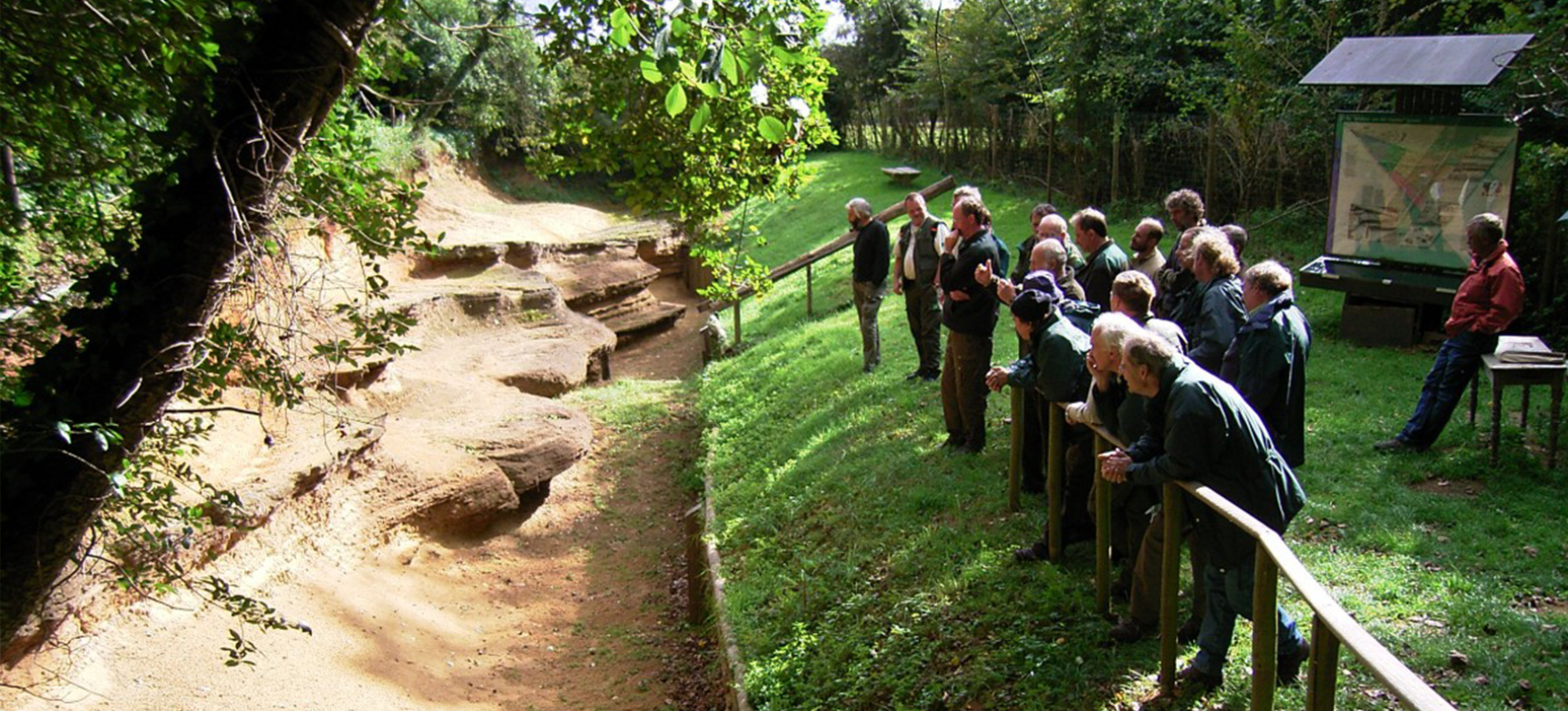
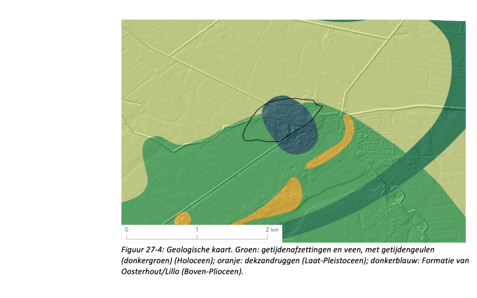
The 'Meester Van der Heijden quarry' is located approximately at the highest point of Nieuw-Namen. The main deposits visible in the quarry are shell-bearing sands named in the Netherlands as Formation of Oosterhout (Pliocene) and in Belgium as Formation of Lillo. Striking features in the quarry are the rust-brown sands at the top and the yellow layered sands at the bottom, containing a number of hard ironstone beds protruding from the wall. The two sand layers are separated by a thick layer of shell fragments glued together by lime (shell breccia). There is thus a clear dichotomy: at the bottom sand deposited during the warm Pliocene, above it cover sand blown across the landscape by wind during the Ice Age. Between the two is a large time gap of about three million years.

Neogene

During the Paleogene and Neogene, the Netherlands and Low and Central Belgium were largely covered by a shallow sea, in which mainly sand and clay was deposited. Towards the end of the Neogene, the sea slowly retreated. On a beach of this sea, the shell-bearing sands of Nieuw-Namen were deposited around 3 million years ago. Probably the deposition of these sands did not stop with this, and several tens of meters of similar shell sands were deposited on top of the deposits visible in the quarry. Later erosion of these deposits during the Pleistocene left from this package the shells now concentrated in the thin layer of shell breccia.

Pleistocene river erosion

After the final disappearance of the sea from the area, northward-flowing rivers from the Scheldt Basin lowered the land surface by at least 10 to 20 meters during the last 1 million years. Due to the absence of intervening deposits, it is impossible to reconstruct the landscape evolution during this period in detail; only the broad outlines are known. It is possible that during this long interval, the iron-sandstone banks were formed by ironification of the sand. The preservation of the hill of Nieuw-Namen is probably partly due to the presence of these hard and more resistant ironstone layers.

The last ice age

During the last ice age (the Weichselian), the area of Nieuw-Namen was a tundra where only grasses, mosses and dwarf shrubs grew during the coldest phases. The ground was completely or partially frozen. Winds blew over the virtually unprotected land and deposited a thin layer of cover sand like a blanket over the landscape. With the improvement of the climate and the expansion of vegetation at the beginning of the Holocene, about 12,000 years ago, the erosion phase of the last ice age came to an end The sea level rise due to the melting of the large land ice caps caused a general increase of the groundwater level in the cover sand area, causing peat to grow in the lower parts of the landscape around Nieuw-Namen. After the Roman Period, the landscape around "getuigenheuvel" changed into a tidal area with mudflats, salt marshes, and gullies

Visit via: Kerkpad 2, 4568 AK Nieuw Namen, Netherlands