This detour, a 7.3-kilometer walk along Oostdijk's most striking landmarks, was put together by villagers. For this detour (purple line on map), follow the yellow directional arrows with the Verdronken Dorp (Drowned Village) logo along the way. You can also extend the route via the other (node) numbers of the walking network.
The village was first mentioned as Heerlijkheid Oostdijk in 1242. Nothing can be found of that settlement since it was lost during floods in 1530 and 1532. Only in the year 1642 was the village partially rebuilt to prevent new floods. Despite this, Oostdijk was nevertheless trodden by the 1953 flood disaster. Large parts of the village were under water and the damage was enormous. Because of the great togetherness, which is characteristic of the village, Oostdijk was able to recover. Agriculture is still the pillar on which the Oostdijk economy thrives. The village has a population of 575 (2021).
-
De Juun
The onion, in good dialect “juun”, is the trademark of Oostdijk, where much fruit is also grown. The juun and Oostdijk are a binary entity. This is immediately obvious as you approach the village from the south. Next to the traffic circle at the Oude Rijksweg stands a life-size work of art in the shape of an onion, conceived, designed and executed by local residents.
-
Breakthrough Lavendeldijk/school
At the site where the school stood, the Lavender River broke through. A deep stream hole was created. This breach almost completed the total demise of the hamlet of Oostdijk. With 40,000 sandbags and much manpower, the wide stream hole was later closed.
-
De Vliet
In earlier times, Zuid-Beveland was intersected by numerous watercourses and small estuaries. The Vliet, actually the 'Kruiningse Vliet', was formed during a great flood in 1134. This sea arm flowed between the Western Scheldt and Eastern Scheldt and later had a drainage function. What we still see today is a beautiful small nature reserve, a foraging area for water birds.
-
De coupre (cutoff)
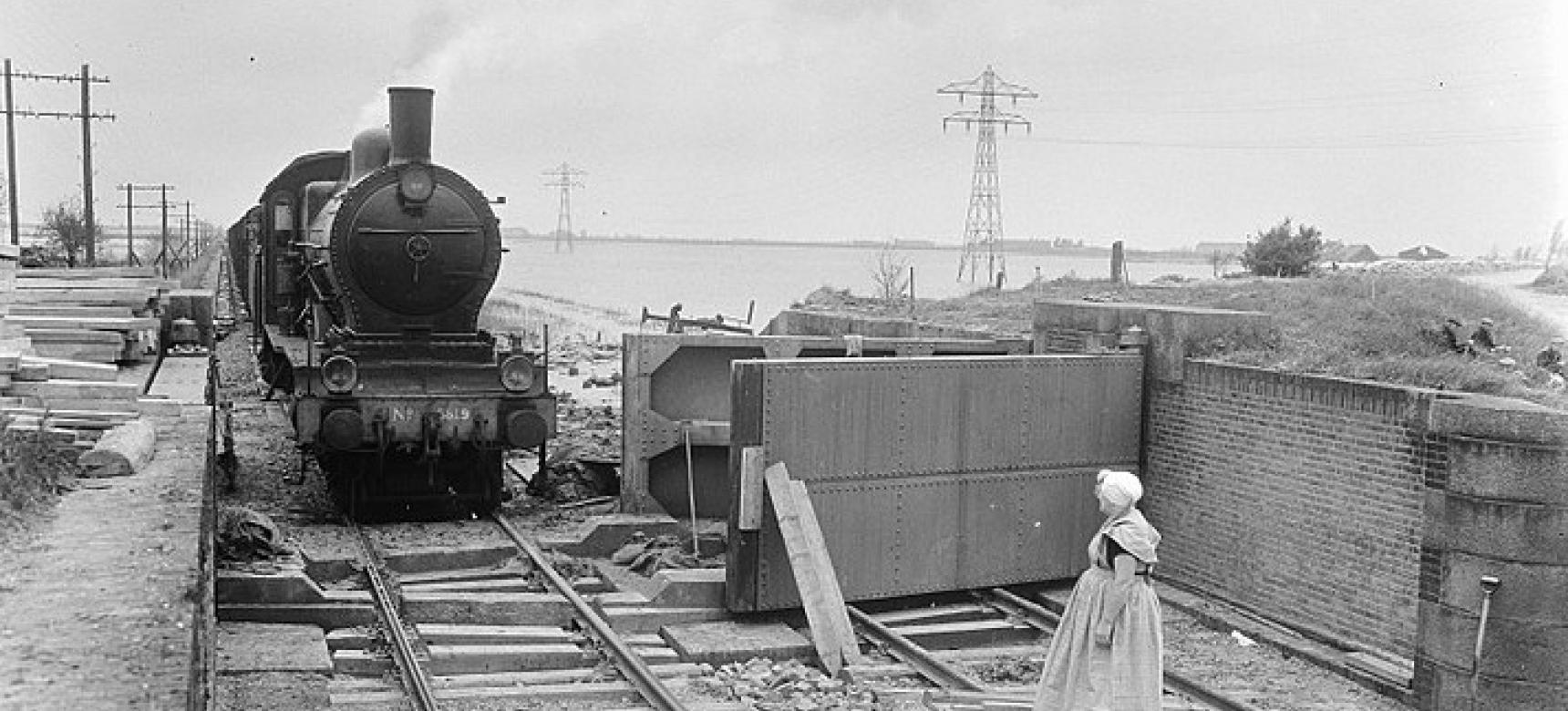
Inhabitants of the coupure, the lockable passage in the Nieuwlandse Binnendijk, were able to close it in the nick of time on Sunday morning, February 1, 1953. Had they not succeeded, the village of Krabbendijk would have been flooded as well. After the railroad line was later restored, freight trains could again travel through the drowned polder at low tide. To do this, the steel coup doors had to be opened at all times.
-
Het Hoekje
The corner (Het Hoekje) is the point where many roads converge; it is a meeting place. It used to be. When many people went to work for farmers, people waited for each other there. Still today it is the place where schoolchildren meet on their way to school. Here, on the night of the disaster, the water poured down over the causeway with great force.
-
Village hall
After the disaster, the municipality of Apeldoorn donated a wooden emergency building to Oostdijk. “'t Gebouwtje” (the building), as everyone called it for many years, served for a long time as an elementary school and as an association building. The current stone village hall is still called 'Apeldoorn'. On the plaque are the names of the victims of the flood.