Origin of the landscape
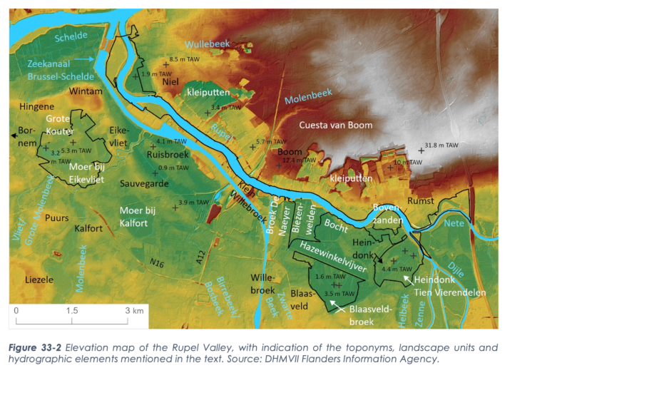
During the Pleistocene, the precursors of today's rivers of the Scheldt Basin entered the Flemish Valley. At that time, the present Rupel Valley formed a branch of the Flemish Valley, within which flowed a braiding river that deposited sand. At the end of the last ice age, the Scheldt took its present course, and the Rupel ran with the Scheldt through the "breakthrough valley of Hoboken". During the Late Glacial, the braided river system changed into a wide meandering river. Along the meandering channels, riparian banks and serpentine ridges formed: elongated sandy heights parallel to the river. These channels and ridges are buried under younger deposits in the Rupel Valley, but are sometimes still recognizable in the micro-relief. When a forest vegetation developed, the filling of the meander channels started. A very last cold phase caused a barren landscape and the formation of river dunes. In the Rupel Valley, among other things, the elevations within the Blaasveldbroek are attributed to late glacial wind action.

