Between nature and humans

Tropical sea to ice age

About 30 million years ago, the site of the Scheldt estuary was a shallow, tropical sea. Shark teeth from that time still wash up on the beaches of Nieuwvliet-bad, Ritthem and the Kaloot. After the sea retreated, some 3 to 2.5 million years ago, a coastal plain emerged into which rivers flowed. Traces of this coast can still be found in Nieuw-Namen/Kieldrecht near the Meester van der Heijden quarry. The river deposits are found in the Brabant Escarpment.

In the penultimate ice age, 280,000 to 130,000 years ago, the predecessor of the Scheldt created a deep valley system north of present-day Ghent: the Flemish Valley. This was later largely filled in and is now a low, flat and sandy area. As a result of erosion by the river, the northern side of the Flemish Valley eroded strongly, creating a landscape there with asymmetrical relief: the Oedelem-Zomergem Cuesta in Meetjesland, the Waasland cuesta and the Boom cuesta.

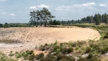
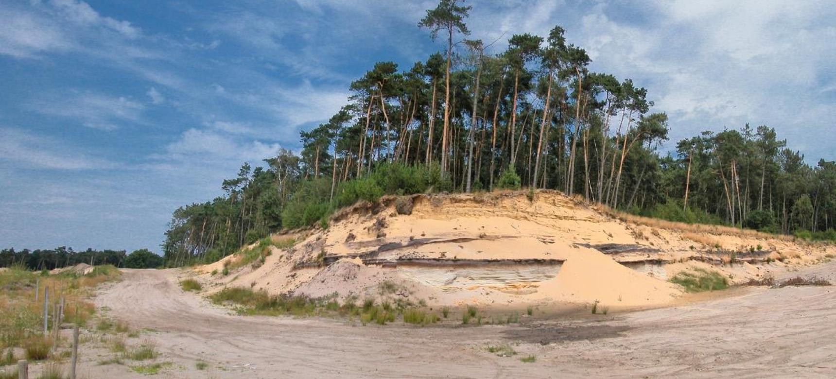
During the ice ages, the sea level dropped because water was stored in the ice caps. In the coldest part of the last ice age, about 18,000 years ago, the North Sea was even completely dry. From this plain, powerful winds carried sand, creating elongated blanket sand ridges.


Kaloot - Van tropische zee tot Schelde

Coastal area

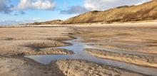
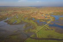
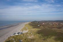
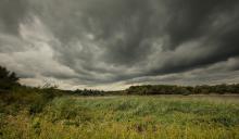
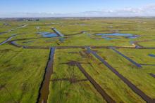
Due to the melting ice caps, the North Sea basin began to fill up again starting about 10,000 years ago. The coastal plain became wetter and peat bogs formed. As a result of continued sea level rise, the sea penetrated the area through gullies and drowned the peat bogs. When the sea level rise decreased from about 3700 B.C., mud flats and salt marshes developed in large parts of Zeeland. Along the coastal zone, sand barriers were formed that began to seal off the area behind them. On the sand barriers, the first dunes developed. Starting around 3000 B.C., the sea brought in a lot of sand, causing the sand barriers to grow. The area behind the sand barriers swelled. Here peat formation took place on a large scale.

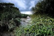
Due to intrusions by the sea and drainage in Roman times, tidal creeks were formed in the peat landscape behind the old dunes from 300 AD. As a result, the peat area was washed away or covered with a layer of clay. This gave Zeeland its characteristic island structure. The influence from the sea reached to where the higher sandy soils begin in the north of Flanders.


The Old Scheldt

Shortly before the end of the last ice age, the Scheldt, Rupel, Dender, Durme and Lys flowed via the Flemish Valley into the then still dry North Sea basin.

Due to the accretion of the cover sand ridge between Maldegem and Stekene, the Scheldt, into which the Durme also flowed, was forced to flow north through the breakthrough valley near Hoboken to the dry North Sea plain. In 2 million-year-old soil layers, the river scoured out a steep ridge, the Brabant Escarpment.

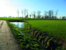
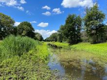
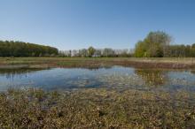
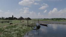
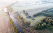
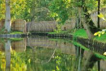
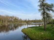
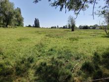
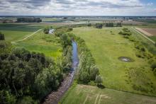
During the Late Glacial (15,500 to 11,500 years ago), the shallow and broadly spreading Scheldt changed into a strongly meandering river system with a lot of water discharge. A characteristic feature of the meander pattern is that the outside of the river bends erodes, while material is deposited on the inside. As a result, the river course gradually shifts toward the outside of the bends. On the inside, crescent-shaped embankments (meander-valley ridges) formed with depressions in between. Peat growth filled up most of the old channels. Especially between Ghent and Dendermonde, large Paleomeanders of the Scheldt have been preserved. The best recognizable are those in Berlare.

River dunes, also called donks, formed at several places along the Scheldt.

About 5400 to 4300 years B.C., the Scheldt west of bergen op Zoom made a connection to the sea, the beginning of the present Eastern Scheldt.
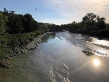
 

Scheldt Estuary

During the peat bog phase, the Scheldt turned into a relatively narrow river. But intrusions from the sea caused significant widening from about 300 A.D. Dan again. An estuary came into being.

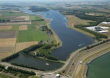
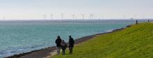
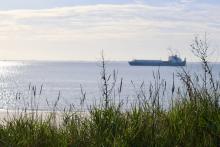
Presumably no earlier than the eighth century, the Honte, a creek that flowed into the Scheldt in the eastern part of Zeeland, became connected with break-in channels from the North Sea and the forerunner of today's Western Scheldt came into being. From the fifteenth/seventeenth century, this became the main course of the Scheldt. With the new, shorter connection to the North Sea, tidal action became noticeable further upstream in the river. Sea level rise and reclamation later reinforced this process. Today, tidal action is still noticeable upstream from Vlissingen for about 160 kilometers.

The course of the river also changed upstream. At the beginning of the thirteenth century, the Scheldt shifted its course to the west near Weert; the main stream then separated from the Old Scheldt.


Human intervention

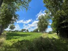
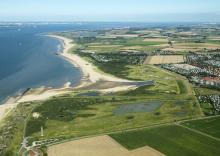
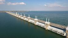
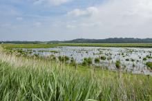
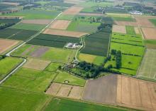
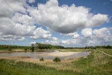
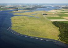
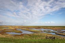
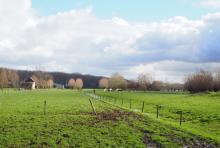
From Roman times onward, but especially from the Middle Ages onward, man began to leave his mark on the landscape. At the beginning of the twelfth century, Zeeland and the north of Flanders started with large-scale embankments, after local defensive dikes had already been constructed in Roman times (see also storyline Living with the water). Thus came into being old land polders, such as the polder Walcheren, the polder Schouwen and the wide Wateringen to the west and east of Yerseke, which were characterized by higher sandy creek ridges and lower pool soils. In later reclamations, mud flats and salt marshes were often diked against existing polders (washes) or tidal flats (washes). This is how loose islands in Zeeland became connected.


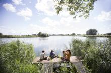
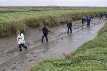
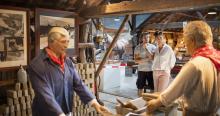
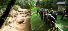
Discover and experience

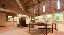
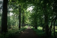
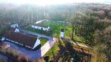
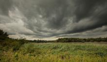
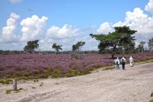
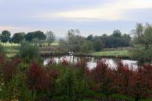
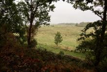
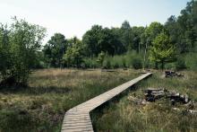
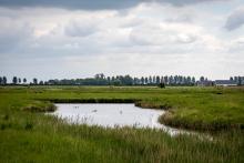
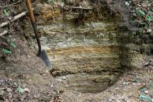
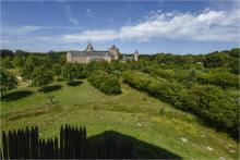
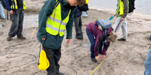
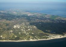
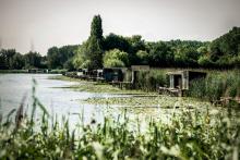
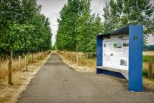
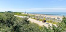
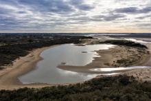
You can read about the geological history at the quarries in this area, including the Meester Van der Heijden quarry in Nieuw Namen and Boudewijn quarry in Ossendrecht, both of which are geological monuments. In Rumst there is an information point about the origins of the Boom clay. The Drongengoedhoeve in Ursel explains the geological history of the Zomergem-Oedelem cuesta. You can experience the rich variety of nature in the area in the nature reserves and landscape parks, including the cross-border Zwin region, border park Groot-Saeftinghe and border park Kalmthoutse Heide. At Overmere-donk and Berlare Broek the old Scheldemeand formation can be recognized by the water lakes created after peat extraction that follow the old meander and by the bumpy pattern of the meander ridges. Between Bornem and Weert you will find an almost intact thirteenth-century Scheldt landscape with a strongly closed character. The Drowned Land of Saeftinghe gives an impression of the unimproved salt marshes and mud flats that once characterized Zeeland. Creek ridges are recognizable in the landscape of Walcheren. Creek remnants can be found as Zwin, Zwake, Schenge and Passageule, among others. The Kop van Schouwen is home to a vast dune landscape.


Type
Bezoekerscentrum Donkmeer een startpunt voor veel wandel- en fietsroutes

Donkmeer Visitor Centre

Read more
Bolle akkers vlakbij Barbierbeek

Barbierbeek Valley

Read more
Bolle akkers vlakbij Barbierbeek

Barbierbeekvallei

Read more
Strandwal Walcheren

Beach ridge of Walcheren

Read more
Bezoekerscentrum Donkmeer een startpunt voor veel wandel- en fietsroutes

Bezoekerscentrum Donkmeer

Read more
Actieve winningsput Boomse klei

Boom Cuesta

Read more
Luchtfoto Verdronken Land van Saeftinghe

Border park Groot Saeftinghe

Read more
Wandelende mensen in Grenspark Kalmthoutse Heide

Border park Kalmthoutse Heide

Read more
Braakmanregio Kreken van Assenede

Braakman region

Read more
Luchtfoto Braakmanregio

Braakmanregio

Read more
Kalmthoutse heide Kriekelareduinen

Brabant Escarpment - Kalmthoutse Heide

Read more
Kalmthoutse heide Kriekelareduinen

Brabantse Wal - Kalmthoutse Heide

Read more
De Schelde bij Weert - zoetwaterschorren langs de Schelde

Brackish tidal marshes of the Scheldt

Read more
De Schelde bij Weert - zoetwaterschorren langs de Schelde

Brakwaterschorren Zeeschelde

Read more
Kustduinen Zuidwest Walcheren

Coastal dunes of southwest Walcheren

Read more
Damse Vaart

Coversand area Sint Jansteen

Read more
Hollandersgatkreek

Creek and coversand area Sint-Margriete - Aardenburg

Read more
Kreekruggen en Poelgronden Walcheren

Creek ridges and pool grounds of Walcheren

Read more
Actieve winningsput Boomse klei

Cuesta van Boom

Read more
Maldegemveld, Drongengoedbos (gemaakt door Toerisme Oost-Vlaanderen)

Cuesta van Oedelem-Zomergem

Read more
Waterleidingbos bij Sint-Jansteen

Dekzandgebied St. Jansteen

Read more
Brabantse Wal, Noordpolder

Dintelse Gorzen

Read more
Brabantse Wal, Noordpolder

Dintelse Gorzen

Read more
Drongengoedbos (gemaakt door Justine Bonne, Toerisme Oost-Vlaanderen)

Drongengoed Farm

Read more
Drongengoedbos (gemaakt door Justine Bonne, Toerisme Oost-Vlaanderen)

Drongengoedhoeve

Read more
Verdronken Land van Saeftinghe

Drowned Land of Saeftinghe

Read more
Verdonken-Zwarte-Polder_-West-Zeeuws-Vlaanderen-slikken_-schorren-en-duingebied-direct-aan-zee-gemee.jpeg

Drowned Zwarte Polder

Read more
Mottekasteel bij Terra Maris, Duingebied Oranjezon en de Manteling

Duingebieden Oranjezon en de Manteling

Read more
Manteling-van-Walcheren

Dune complex Oranjezon and the Manteling

Read more
Veerpont Tielrode-Hamme Durme Mirabrug

Durme Valley

Read more
Veerpont Tielrode-Hamme Durme Mirabrug

Durmevallei

Read more
Voormalige getijdengeulen (gemaakt door Bas van Oort)

East Flanders Creeks Area

Read more
Oosterschelde - Stormvloedkering

Eastern Scheldt

Read more
Bezoekers wandelen langs de getijdgeul Hammen in de gemeente Schouwen, Oosterschelde

Eastern Scheldt Week

Read more
Bezoekers in de modder tijdens een excursie in het Verdronken Land van Saeftinghe

Excursie in het Verdronken Land van Saeftinghe

Read more
De Schelde bij Weert - zoetwaterschorren langs de Schelde

Freshwater tidal area and polders of the Scheldt

Read more
Tentoonstelling geheim van de cuesta Geopark Schelde Delta

Geheim van de cuesta

Read more
Luchtfoto Verdronken Land van Saeftinghe (gemaakt door Marcelle Davidse)

Grenspark Groot Saeftinghe

Read more
Wandelende mensen in Grenspark Kalmthoutse Heide (gemaakt door Aart van Belzen)

Grenspark Kalmthoutse Heide

Read more
Speurtocht naar onderwaterleven tijdens de Grevelingenweek

Grevelingenweek

Read more
Speurtocht naar onderwaterleven tijdens de Grevelingenweek

Grevelingenweek

Read more
Collectie streekdracht in Het Warenhuis - Het museum over het land van Axel

Het Warenhuis

Read more
Collectie streekdracht in Het Warenhuis - Het museum over het land van Axel

Het Warenhuis

Read more
Zwin Bezoekerscentrum

Het Zwin Bezoekerscentrum

Read more
Uitzicht op de Hooge Platen (Het Zeeuws Landschap)

Hooge Platen

Read more
Uitzicht op de Hooge Platen (Het Zeeuws Landschap)

Hooge Platen

Read more
Kleigroeve steengelaag

Kleigroeve Steengelaag

Read more
Welen Zuid-Beveland

Kolk lakes Zuid-Beveland

Read more
Kop van Schouwen

Kop van Schouwen

Read more
Kop van Schouwen

Kop van Schouwen

Read more
Kreekruggen en Poelgronden Walcheren

Kreekruggen en poelgronden Walcheren

Read more
Hollandersgatkreek

Kreken- en dekzandgebied Sint-Margriete - Aardenburg

Read more
Kustduinen Zuidwest Walcheren

Kustduinen Zuidwest Walcheren

Read more
Uitzicht tussen bomen door op het Markiezaatsmeer

Markiezaat

Read more
Uitzicht tussen bomen door op het Markiezaatsmeer

Markiezaat

Read more
Meiduinen Groeve Boudewijn (gemaakt door Walter Jonkers)

Meiduinen & Groeve Boudewijn

Read more
Meiduinen Groeve Boudewijn (gemaakt door Walter Jonkers)

Meiduinen & Groeve Boudewijn

Read more
Tentoonstelling in het Mercatormuseum

Mercator Museum

Read more
Tentoonstelling in het Mercatormuseum

Mercatormuseum

Read more
Moervaartdepressie

Moervaart depression and coversand ridge

Read more
Kanoën op de Moervaart (gemaakt door Machteld Bats)

Moervaartdepressie en dekzandrug

Read more
Gevonden skelet tentoongesteld in het Museum Aardenburg

Museum Aardenburg

Read more
Gevonden skelet tentoongesteld in het Museum Aardenburg

Museum Aardenburg

Read more
Museum Hulst

Museum Hulst

Read more
Voorkant van museum Hulst

Museum Hulst

Read more
Bezoekers bekijken de tentoonstelling in het Museum Rupelklei

Museum Rupelklei

Read more
Bezoekers bekijken de tentoonstelling in het Museum Rupelklei

Museum Rupelklei

Read more
bezoekers bekijken de groeve

Nieuw-Namen

Read more
bezoekers bekijken de groeve

Nieuw-Namen

Read more
Maareberg Noordpolder (gemaakt door Piet Bout)

Noordpolder - Calfven

Read more
Maareberg Noordpolder (gemaakt door Piet Bout)

Noordpolder - Calfven

Read more
Drongengoedbos - Bos- en heidegebied op cuesta Oedelem-Zomergem

Oedelem-Zomergem Cuesta

Read more
Voormalige getijdengeulen (gemaakt door Bas van Oort)

Oost-Vlaamse Krekengebied

Read more
Oosterschelde - Stormvloedkering

Oosterschelde

Read more
Bezoekers wandelen langs de getijdgeul Hammen in de gemeente Schouwen, Oosterschelde

Oosterscheldeweek

Read more
Otheensekreek

Otheense kreek

Read more
Otheensekreek

Otheense kreek

Read more
De Poel, Hoeve vd Meulen bij 's-Heer Abtskerke

Oudland area de Poel

Read more
Oudlandgebied de Putting

Oudland area De Putting

Read more
De Poel, Hoeve vd Meulen bij 's-Heer Abtskerke

Oudlandgebied de Poel

Read more
Oudlandgebied de Putting

Oudlandgebied De Putting

Read more
Eendenkooi, Kalkense Meersen - Berlare Broek

Paleomeanders Kalkense Meersen and Berlare

Read more
Eendenkooi, Kalkense Meersen - Berlare Broek

Paleomeanders Kalkense Meersen en Berlare

Read more
Paleovallei van de Oude Kale (gemaakt door Jonas Vandecasteele - Toerisme Leiestreek)

Paleovallei Oude Kale

Read more
Oude Kalevallei

Paleovalley of the Oude Kale

Read more
Pluimpot

Pluimpot

Read more
Pluimpot

Pluimpot

Read more
Rupelmondse Kreek (gemaakt door Walter Jonkers)

Polders van Kruibeke

Read more
Rupelmondse Kreek (gemaakt door Walter Jonkers)

Polders van Kruibeke

Read more
Foto van Reizende Tentoonstelling

Reizende Tentoonstelling

Read more
Zoetwaterschorren langs de Schelde - Rivierpark Scheldevallei (gemaakt door Arjen Hartog)

Rivierpark Scheldevallei

Read more
Streekgerechten uit de Rupelstreek

Rupel Valley

Read more
Streekgerechten uit de Rupelstreek

Rupelvallei

Read more
Zoetwaterschorren langs de Schelde - Rivierpark Scheldevallei (gemaakt door Arjen Hartog)

Scheldt Valley River Park

Read more
Brabantse Wal, De Bunt - Pleistocene rivier-

Smalle Beek

Read more
Brabantse Wal, De Bunt - Pleistocene rivier-

Smalle Beek Valley

Read more
Kleigroeve steengelaag

Steengelaag clay quarry

Read more
Strandwal Walcheren

Strandwal Walcheren

Read more
Museum voor Natuur en Landschap Terra Maris

Terra Maris

Read more
Museum voor Natuur en Landschap Terra Maris

Terra Maris

Read more
Veerse Meer

Veerse Meer and Schenge

Read more
Veerse Meer

Veerse Meer en Schenge

Read more
Verdronken Land van Saeftinghe

Verdronken Land van Saeftinghe

Read more
Verdonken-Zwarte-Polder_-West-Zeeuws-Vlaanderen-slikken_-schorren-en-duingebied-direct-aan-zee-gemee.jpeg

Verdronken Zwarte Polder

Read more
Luchtfoto Kop van Schouwen (Sky Pictures)

Vroon grounds and Verklikker dunes

Read more
Luchtfoto Kop van Schouwen (Sky Pictures)

Vroongronden en Verklikkerduinen

Read more
Uitzicht tussen Elversele en Temse

Waasland Cuesta

Read more
Waasland Kreken van Saleghem

Waasland Scheldt Polders

Read more
Uitzicht tussen Elversele en Temse

Wase Cuesta

Read more
Wase Scheldepolders - Koningsdijk Staats-Spaanse Linies

Wase Scheldepolders

Read more
Uitzichtpunt Watertoren Rumst

Water Tower Rumst

Read more
Uitzichtpunt Watertoren Rumst

Watertoren Rumst

Read more
Fietsers langs de kustlijn in de Zwinstreek

Week van de Zwinstreek

Het Zwin
Read more
Welen Zuid-Beveland

Welen Zuid-Beveland

Read more
Westerschelde

Western Scheldt

Read more
Westerschelde

Westerschelde

Read more
Yerseke Moer

Yerseke and Kapelse Moer

Read more
Yerseke Moer

Yerseke en Kapelse Moer

Read more
De Schelde bij Weert - zoetwaterschorren langs de Schelde

Zoetwatergetijdengebied en polders Schelde

Read more
Zuidkust Schouwen (gemaakt door Marcelle Davidse)

Zuidkust van Schouwen

Read more
Zuidkust Schouwen (gemaakt door Marcelle Davidse)

Zuidkust van Schouwen

Read more
Passageule

Zwin creek remnants and Passageule

Read more
Hingene - kasteel d'Ursel

Zwin polders around Damme

Read more
Zwin Bezoekerscentrum

Zwin Visitor Centre

Read more
Passageule

Zwinkreeksrestanten en Passageule

Read more
Relict Lieve en Lievebermen tussen Moerkerkebrug en Schipdonkvaart-Zuid

Zwinpolders rond Damme

Read more
Fietsers langs de kustlijn in de Zwinstreek

Zwinweek

Het Zwin
Read more