Living with the water

Fighting or moving with it?

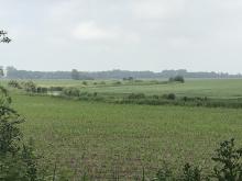
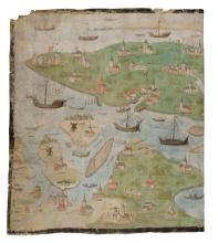
Over the centuries, dealing with water required great decisiveness and enterprise. Between the 11th and 16th centuries, Zeeland and Flanders were hit by countless storm surges. Lost land was re diked if possible, but sometimes shortly afterwards it was swallowed by the sea. Sometimes the inhabitants of the Scheldt estuary were themselves partly to blame for the disasters. Neglected dikes and subsidence due to marsh drainage increased the danger. Some floods were caused by poor drainage due to the silting up of rivers and canals. In addition, the increase of reclaimed land from the twelfth century caused the water to have less space. Many times land was also inundated for military reasons (see story line Contested area).


Koudekerksche Inlaag - Zilte natuur met de toren van verdronken dorp Koudekerke (Marcelle Davidse)

Protecting?

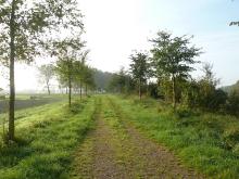
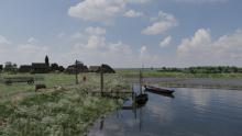
The first people to settle on the still unimproved land behind the sand barriers and in the Scheldt Valley did so on the higher ground. They are sometimes still recognizable by farms and village centers located higher in the landscape. In Roman times, people built dikes to protect themselves from the water. From the tenth century on, relatively densely populated areas in the salt marshes were also protected with dikes and open creeks were dammed up. As the population increased, it became necessary to protect larger areas.


Kolk lakes and creeks

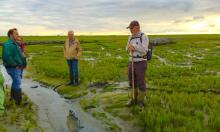
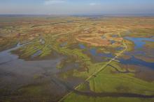
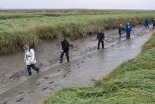
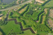
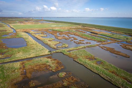
After floods, welen and creeks remained as "scars" in the landscape. When a dike was breached, a round and deep sinkhole (weel or wiel) was created, around which a new dike was often built. Many creeks in Zeeuws-Vlaanderen and Meetjesland are also remnants of floods, including military inundations. Other creeks are a remnant of original tidal creeks.
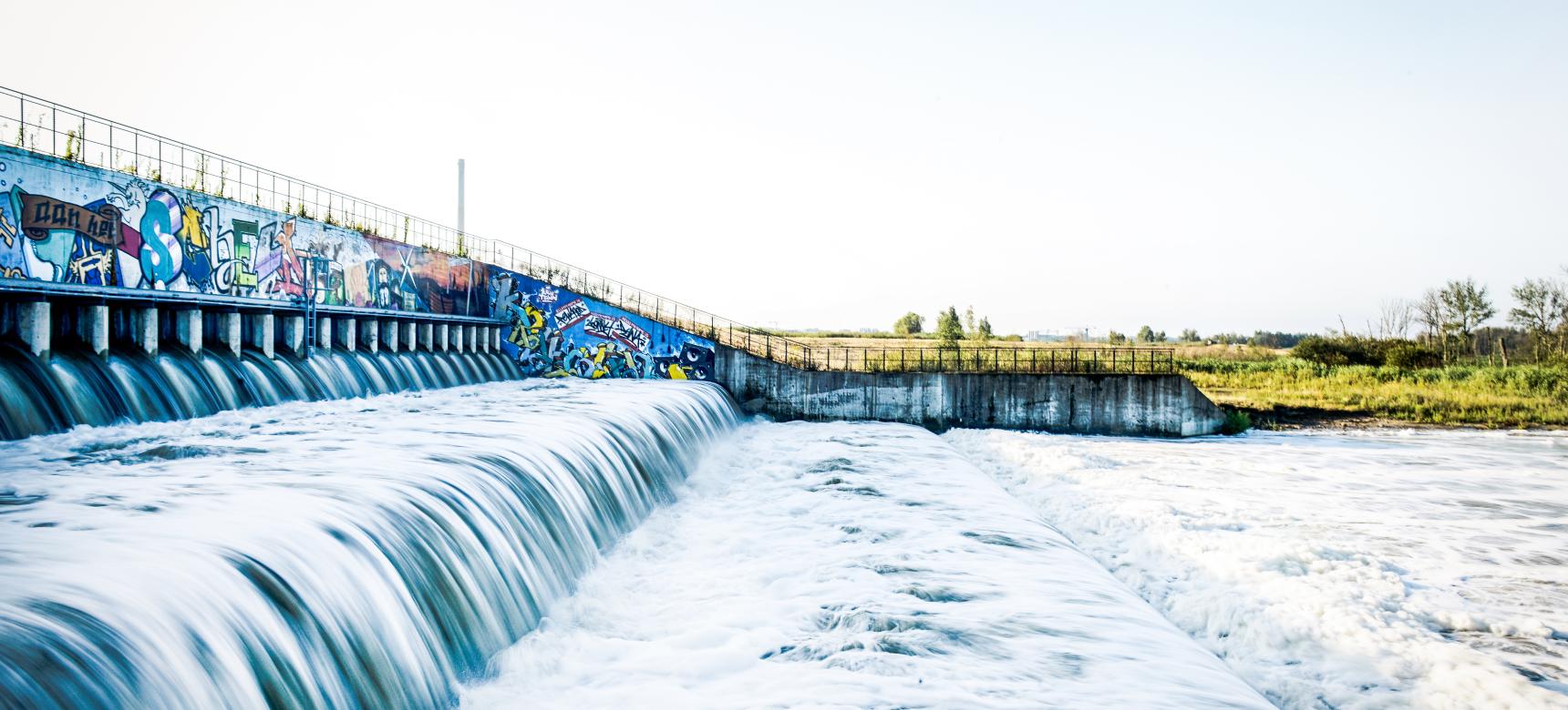
 

Sigma Plan

From the end of the nineteenth century, the level of high water in the Scheldt increased more strongly, partly due to large-scale reclamation and the construction of the Kreekrakdam, which closed the connection between the Eastern and Western Scheldt. To deal with floods, "pot polders" were constructed along the Durme in 1930, also part of the Sigma Plan.


Zoetwatergetijdegebied en SIGMA overstromingspolder (Sandra Koning, Toerisme Oost-Vlaanderen)

Delta Works

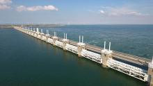
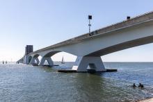
The 1953 flood disaster ushered in the Delta Works. A technical tour de force that, due to the decades it took to complete, itself became the reflection of changing technical and ecological insights. Dikes were raised to the height of the Delta, dams closed off estuaries and the Eastern Scheldt was given a barrier that only had to be closed during storm surges.


Moving?

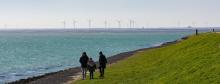
The Scheldt estuary remains in constant flux. At this time, global warming and sea level rise require new solutions. Lessons from the past and natural processes can help us with this (see also storyline Climate Living Lab).


Discover and experience

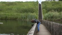
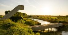
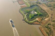
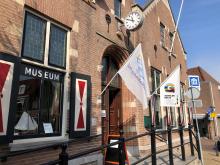
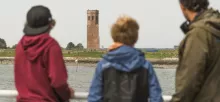
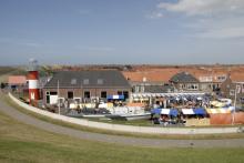
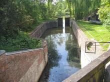
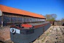
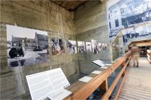
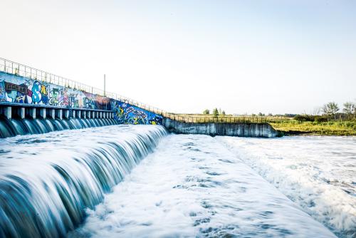
The 1953 flood disaster is the subject of the Flood Museum in Ouwerkerk. The Plompe Toren of drowned Koudekerke on the south coast of Schouwen is an iconic landmark. The sea dike at Westkapelle is considered a hydraulic icon. On the south coast of Schouwen and the north coast of Noord-Beveland, inlagen are stringing together. The Zak van Zuid-Beveland is dotted with kolk lakes. An illustrative combination of an elevated village center and farms can be found in the village of Kloetinge and the nearby farmstead Tervaeten. In Bornem, remnants of the Nethof farmstead and the Pastoor Huveneersheuvel recall the medieval settlement of Nattenhaasdonk. Hildernisse, at the foot of the Brabant Escarpment, is the last flood farm in the Netherlands, although it no longer serves as such due to construction of the Markiezaatskade. The Eastern Scheldt barrier can be visited via Deltapark Neeltje Jans. The waterfalls of Kruibeke, part of the Sigma Plan, are a tourist attraction at high tide. Polders throughout the area house numerous locks and other hydraulic works.


Type
Wandelaars

Avontuurlijke tocht door Zuid-Beveland

Read more
Bezoekers kijken met een verrekijker over de Oosterschelde tijdens de boottocht

Boottocht op de Oosterschelde

Read more
Bezoekers kijken met een verrekijker over de Oosterschelde tijdens de boottocht

Boottocht op de Oosterschelde

Read more
Luchtfoto Verdronken Land van Saeftinghe

Border park Groot Saeftinghe

Read more
Damse Vaart

Damse Vaart

Read more
Damse Vaart

Damse Vaart

Read more
Deltawerken - Oosterscheldekering

Delta Works & Neeltje Jans

Read more
Deltawerken - Oosterscheldekering

Deltawerken & Neeltje Jans

Read more
Snorkellende vrouw (gemaakt door Lars H Knudsen)

Diving safari

Read more
Verdronken Land van Saeftinghe

Drowned Land of Saeftinghe

Read more
Bezoekers wandelen langs de getijdgeul Hammen in de gemeente Schouwen, Oosterschelde

Eastern Scheldt Week

Read more
Bezoekers in de modder tijdens een excursie in het Verdronken Land van Saeftinghe

Excursie in het Verdronken Land van Saeftinghe

Read more
Droge voeten door de Mozesbrug bij Fort De Roovere

Fort de Roovere

Read more
Droge voeten door de Mozesbrug bij Fort De Roovere

Fort de Roovere

Read more
Uitkijktoren Fort Henricus

Fort Henricus

Read more
Uitkijktoren Fort Henricus

Fort Henricus

Read more
Luchtfoto Fort Liefkenshoek

Fort Liefkenshoek

Read more
Luchtfoto Fort Liefkenshoek

Fort Liefkenshoek

Read more
Luchtfoto Fort Pinssen

Fort Pinssen

Read more
Luchtfoto Fort Pinssen

Fort Pinssen

Read more
De Getijdenmolen in Rupelmonde

Getijdenmolen Rupelmonde

Read more
Luchtfoto Verdronken Land van Saeftinghe (gemaakt door Marcelle Davidse)

Grenspark Groot Saeftinghe

Read more
Speurtocht naar onderwaterleven tijdens de Grevelingenweek

Grevelingenweek

Read more
Speurtocht naar onderwaterleven tijdens de Grevelingenweek

Grevelingenweek

Read more
Halte Arsenaal van de Zonnetrein (zonnetreinzeeland.nl)

Guided Walk Vlissingen

Read more
Watersnoodhuis

Het Watersnoodhuis

Stavenisse
Read more
Watersnoodhuis

Het Watersnoodhuis

Stavenisse
Read more
Bezoeker bekijkt expositie in Historisch Museum De Bevelanden

Historisch Museum De Bevelanden

Read more
Bezoeker bekijkt expositie in Historisch Museum De Bevelanden

Historisch Museum De Bevelanden

Read more
Wandelaars door de schorren van Sint-Annaland in Tholen Geopark Schelde Delta

Laarzentocht op de schorren van Sint-Annaland

Read more
Lapscheurse Gat

Lapscheurse Gat

Read more
Lapscheurse Gat

Lapscheurse Gat

Read more
Moerspuische Watergang

Moerspuische Watergang

Read more
Moerspuische Watergang

Moerspuische Watergang

Read more
Museum Hulst

Museum Hulst

Read more
Voorkant van museum Hulst

Museum Hulst

Read more
Museum Markiezenhof

Museum Markiezenhof

Read more
Museum Markiezenhof

Museum Markiezenhof

Read more
Zeelandbrug

Nationaal Park Oosterschelde

Read more
Foto wandeling

Ommetje Hansweert: Parlevinkerspad (3,7 km)

reimerswaal
Read more
Foto van het monument

Ommetje Krabbendijke: Core with Spirit (5,7 km)

Reimerswaal
Read more
Zweedse huisjes

Ommetje Kruiningen: Flood disaster 1953 (8,5 km)

Reimerswaal
Read more
coupure

Ommetje Oostdijk: Drowned Villages (7,3 km)

reimerswaal
Read more
Dorpshuis

Ommetje Rilland: Old & New (6,7 km)

Reimerswaal
Read more
Zeelandbrug

Oosterschelde National Park

Read more
Ingang van het OosterscheldeMuseum in Yerseke

OosterscheldeMuseum

Read more
Ingang van het OosterscheldeMuseum in Yerseke

OosterscheldeMuseum

Read more
Bezoekers wandelen langs de getijdgeul Hammen in de gemeente Schouwen, Oosterschelde

Oosterscheldeweek

Read more
Mensen aan de Plompe Toren

Plompe Toren

Read more
Mensen aan de Plompe Toren

Plompe Toren

Read more
Polderhuis Westkapelle

Polderhuis Westkapelle

Read more
Polderhuis Westkapelle

Polderhuis Westkapelle

Read more
Foto van Reizende Tentoonstelling

Reizende Tentoonstelling

Read more
Sas bij Bornem (afwateringssluis)

Sas bij Bornem

Read more
Sas bij Bornem (afwateringssluis)

Sas near Bornem

Read more
Fragment Scheldekaart van Rupelmonde tot de Noordzee in Felixarchief Antwerpen

Scheldekaart van Rupelmonde tot de Noordzee in FelixArchief Antwerpen

Read more
Deel uit bebording Ommetjes

Short Walks Reimerswaal

Reimerswaal
Read more
Snorkellende vrouw (gemaakt door Lars H Knudsen)

Snorkelsafari

Read more
Halte Arsenaal van de Zonnetrein (zonnetreinzeeland.nl)

Stadswandeling Vlissingen

Read more
Museum voor Natuur en Landschap Terra Maris

Terra Maris

Read more
Museum voor Natuur en Landschap Terra Maris

Terra Maris

Read more
Oudurp

The Cristercian Detour (8,9 km)

Reimerswaal
Read more
De Getijdenmolen in Rupelmonde

Tidal mill Rupelmonde

Read more
Verdronken Land van Saeftinghe

Verdronken Land van Saeftinghe

Read more
Deel uit bebording Ommetjes

Wandelingen Reimerswaal

Reimerswaal
Read more
Watersnoodmuseum

Waternsoodmuseum - Flood museum

Read more
Watersnoodmuseum

Watersnoodmuseum

Read more
Twee zeehonden staren je aan vanop de Platen van Ossenisse

Zeehonden spotten

Schelde
Read more