Zwin creek remnants and Passageule

This geosite concerns a polder landscape containing the remains of dammed former creek courses and tidal channels, which once originated from the Zwin estuary. In addition, this geosite contains a former tidal system, the Passageule. The Passageule once formed an important connection between the Zwin and Braakman estuaries, but today it has been dammed and partially canalized. Its former courses can still be seen in the landscape of western Zeeuws-Vlaanderen.

51.318024737263, 3.6867872363703

Elevation map of the Passageule geosite

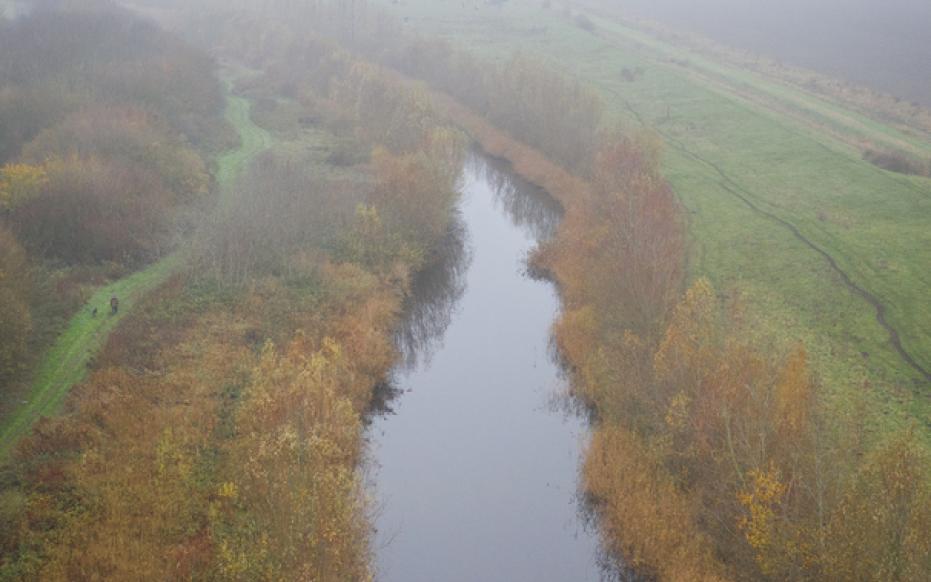
Origin of the landscape

About 2,600 years ago, the coastal barrier created by the decrease in the rate of sea level rise was broken. A decreasing surface area and the scouring action of the tidal channels created several islands in the area, but these often lasted only a few centuries due to tidal dynamics. Medieval embankments played a major role in the development of the creek and gully area. Before the embankments, tidal action naturally caused the land surface to rise above the high tide due to the siltation of salt marshes. As a result, the land was high enough to live on and was mostly used for sheep farming. From various settlement centers, earthen berms and low dikes were constructed on the salt marshes as a preventive measure to counter extreme high water. But this also caused water to rush up against the dikes and sometimes even through dike breaches. In addition, it also caused silted up channels because the sand brought in during low tide could no longer leave the tidal channel.

Mist boven de Passageule (gemaakt door Marcelle Davidse)

Tidal channel the Reie

Tidal channel the Reie is a good example of a silted up tidal channel. It ran from the sea to the important trading center of Bruges, but due to the embankment it slowly silted up and became unnavigable. In the mid-12th century, the people of Bruges moved their harbor to the nearby Zwin, which had just become wider and deeper during storm tides. From this period, the salt marshes on the banks of the Zwin were reclaimed and used as agricultural land, with creek and tidal channel remnants often preserved in the landscape. Eventually the Zwin met the same fate as the Reie. Both the Zwin and the Zwin estuary silted up and became virtually unnavigable for merchant ships in the early 16th century.

Retranchement, voormalig vestigingsstad aan het Zwin (gemaakt door Marcelle Davidse)

Eighty Years' War

During the Eighty Years' War (1568-1648), the Zwin region was in the front line between the Northern (State) Netherlands and the Southern (Spanish) Netherlands. The Zwin dikes southwest and east of Sluis were breached in 1583. The sea penetrated the polders and scoured out several new gully systems. Their mostly rectilinear course indicates that the incoming water largely followed the existing dug waterways. In 1611, part of the flooded area was reclaimed. After the Twelve Year Truce, however, the dikes were breached again. A large area became marshy and uninhabitable. fortifications by both Spanish and State troops and important fortifications were constructed. By 1700, almost all of the inundated area had been reclaimed and only the Zwin estuary with connecting tidal channels remained open. Large parts of the former main course of the Zwin were reclaimed in the 19th century and navigability in the area was increased by the construction of new canals. This put a definitive end to the large tidal channel of the Zwin. Only the creek remnants remained visible in the landscape as dammed, water-filled beds.

Passageule in winterse sferen (gemaakt door Marcelle Davidse)

Passageule

The Passageule was first described in 1470. At first it formed only a tributary of the Braakman, but after the dikes at Sluis were breached at the beginning of the Eighty Years' War, a larger tidal channel formed: the Coxysche Gat. This channel connected the Passageule to Het Zwin, creating a new waterway between the Braakman and the North Sea. Eventually, the connection was permanently closed by the construction of the Kapitale Dam and the Bakkers Dam. As a result, the channel silted up and only a narrow dammed up waterway remained. However, its former reach is still clearly visible in the landscape. The immediate vicinity of the Passageule is somewhat higher than the surrounding polders. This is because the tidal influence along the Passageule has lasted longer than in the surrounding polders.