Fort Pinssen

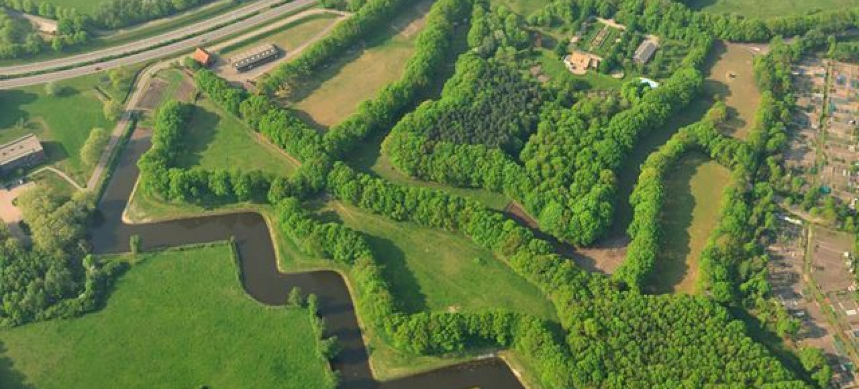
In the 17th century, the cries of soldiers and the sound of cannons could be heard here. Fort Pinssen was built to close a strategic gap in the West Brabant Water Line, between Fort De Roovere and Fort Moermont. Named after Colonel Willem Pijnssen van der Aa, it was an indispensable link in the defence of the hinterland.

Today, it is quiet here. Plants and shrubs have taken over the ramparts, animals find shelter here and walkers follow the rhythm of the paths around the fort. Fort Pinssen is not accessible, but it is surrounded by a beautiful walking area where you can still recognise the old shapes of the fort in the landscape.

51.515975525453, 4.2911385382828

Things to do

  • Walk around the fort along quiet paths in the surrounding countryside.
  • Admire how nature and heritage slowly find balance here.
  • See the contours of the fort, which have been revealed by restoration work.
  • Combine your route with Fort de Roovere or Fort Moermont nearby.
  • Enjoy the woods, water features, and farmland surrounding the defensive structure.

Practical information

  • Location: between Halsteren en Bergen op Zoom.
  • The fort itself is not accessible.
  • The walking routes around it are freely accessible.
  • More information can be found on website of Alliantie Zuidwaterlinie.

What this place tells us about the Geopark

Fort Pinssen was built at a strategic location in the delta landscape. It shows how water, defence and landscape together shaped the area. Now that nature is slowly reclaiming the fort, you can see how a place evolves over time – from a military stronghold to a green haven of tranquillity.